- You are here
- Home
- Guide to Africa
-
- Tanzania Guide
- Tanzania National Parks and Game Reserves
- Mount Kilimanjaro National Park
- Climbing Mount Kilimanjaro
- Climbing Mount Kilimanjaro via the Shira Route
Climbing Mount Kilimanjaro via the Shira Route
Parent page
On this page
Introduction
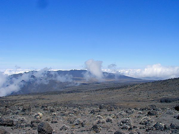
The Shira Plateau west of Kibo is the remains Kilimanjaro’s first volcano. Mawenzi erupted second, and finally, supported by its neighbours, Kibo rose to its great height. Older and more eroded than Mawenzi, the Shira Plateaus ridges and moorland comprise one of Kilimanjaro’s most scenic areas.
The drive to Shira offers magnificent views of the Great African Rift Valley, Mount Meru, and Longido, and the plateaus' parasitic cones extending north of the road, rising from plain to plateau.
The vegetation changes along the route are striking. The plateau is grassland, heath, and moor, with senecios up to 10 meters high in valleys near the cone. You may see Elands on the plateau, and you could come across Buffaloes, Leopards, and other animals. The Shira Cone rises 200 meters above the plateau, and west of the cone is Shira Ridge, a steep rough rise reaching almost 400 meters above the plateau. The southern ridge of the Shira Plateau has two dramatic peaks called Cathedral and the Needle.
The road to Shira is only accessible by 4-wheel-drive vehicles and can become impassable during wet periods. The Shira Route traverses the plateau to join the Machame Route.
Day 1
Moshi /Arusha to Shira Gate to Shira Camp 2
Leave Moshi/Arusha and drive for several hours to the Shira Gate on the western side of Kilimanjaro and register with the national park. Begin hiking, through the rainforest on a winding muddy trail up a ridge. Reach the Shira Camp in the afternoon.
Elevation(m): 915m/1387m to 1830 to 3840m - Distance: 18km - Hiking Time: 5-7 hours - Habitat: Montane Forest
Day 2
Shira Camp 2 to Lava Tower to Barranco Camp
Start by hiking eastwards up a steepening path above the highest vegetation toward Kilimanjaro’s looming mass. After several hours, you walk through a rocky landscape to reach the prominent landmark called Lava Tower at 4630m. This chunky remnant of Kilimanjaro’s earlier volcanic activity is several hundred feet high, and the trail passes right below it. Descend for 2 hours below the lower cliffs of the Western Breach and Breach Wall to Barranco Camp. On this day, be careful to notice any signs of altitude sickness
Elevation(m): 3840m to 4630 m to 3950m - Distance: 15km - Hiking Time: 7 hours - Habitat: Semi-Desert
Day 3
Barranco Camp to Karanga Camp
Start the days hiking up a steep ridge to the Barranco Wall. Topping out just below the Heim Glacier, you can now appreciate just how beautiful Kilimanjaro really is. With Kibo’s glaciers soaring overhead, you descend into the lush Karanga Valley to the Karanga Valley campsite. From the camp, you can look east and see the jagged peaks of Mawenzi jutting into the African sky. Your afternoon is at leisure for resting or exploring. After two long days, this short day is very important for your acclimatization.
Elevation(m): 3950m to 4200m - Distance: 7km - Hiking Time: 4 hours - Habitat: Alpine Desert
Day 4
Karanga Camp to Barafu Camp
In the morning, you hike east over intervening ridges and valleys to join the Mweka Route, which will be your descent route. Turn towards the mountain and hike up the ridge through a sparse landscape for another hour to the Barafu Hut. Your tent will be pitched on a narrow, stony, wind-swept ridge, so make sure that you familiarize yourself with the terrain before dark to avoid any accidents. Prepare your equipment and warm clothing for your summit climb, and drink a lot of fluids.
Elevation(m): 3200m to 4500m - Distance: 13km - Hiking Time: 8 hours - Habitat: Alpine Desert
Day 5
Summit Day! Barafu Camp to Uhuru Peak descend to Mweka Camp
This will be the longest and most challenging day - Your guides will wake you up about mid night to prepare for your 6-hour climb northwest up through heavy scree between the Rebmann and Ratzel glaciers to Stella Point on the crater rim. This is the most challenging part of the route for most climbers. At Stella Point you stop for a short rest and a chance to see a sunrise. Here you also join the top part of the Marangu Route, but do not stop here too long, as it will be extremely difficult to start again due to cold and fatigue. From here you hike along the rim to Uhuru Peak - the summit.
3-hour steep descent back to Barafu Camp, where you can have a short rest prior to hiking into the moorland and eventually into the forest to Mweka Camp. This camp is in the upper forest, so you can expect mist or rain in the late afternoon. The camp office sells drinking water, soft drinks, chocolates, and a welcoming, rewarding beer (depending upon availability)
Elevation(m): 4500m to 5895m, descend to 3100m Distance: 7km up - 23km down - Hiking Time: 8 hours up, 7-8 hours down - Habitat: Scree and seasonal snow
Day 6
Mweka Camp to Mweka Gate to Moshi/Arusha
Easy 3 hour hike back to the park gate, successful climbers receive their summit certificates. Climbers who reached Stella Point are issued green certificates and those who reached Uhuru Peak receive gold certificates. Generally this is the last time you will see your guides, cooks, and porters, so if you were happy with their hard work please remember to tip them once you and all your gear has reached the gate.
Elevation(m): 3100m to 1980m to 890 m/1378m Distance: 15km - Hiking Time: 3 hours - Habitat: Forest

