Malawi Regions and Towns
Parent page
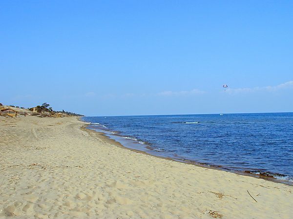
Lake Malawi, is one of Africa's most spectacular Rift Valley lakes, occupying one fifth of Malawi's total land mass, stretching from Tanzania in the North to Mangochi in the south bordering Mozambique on the eastern shoreline.
It is 365 miles long and 52 miles wide and reaches a depth of over 700 metres in the northern parts. It is fed by fourteen rivers and drained by only one, the Shire River in the south.
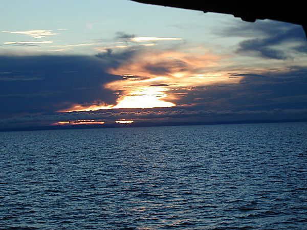
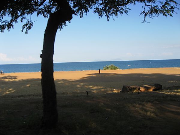
Just about every visitor to Malawi will visit the lake which is regarded as a true tropical paradise, and it's not difficult to see why, with the spectacular surrounding scenery, miles of golden beaches lining the shores of the lake and the crystal clear water. From north to south there are numerous places to stay with a great variety of accommodation to suit most peoples taste and budget. The Lake has become a playground for tourists worldwide and is ideal for watersports, sailing, diving or just relaxing in the sun.


Cichlids
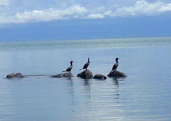
Lake Malawi has over 500 species of tropical fish, some of which are not found anywhere else in the world. Scuba diving is very popular in certain areas providing excellent visibility and safe conditions in clear fresh water.

Bilharzia
In recent years it has been recorded that bilharzia is present in parts of the lake, mainly in the south where the rivers flood in during the raining season. In these areas at these times visibility can be very poor and the lake appears slightly muddy.
Koronga is the main town in the far northern of the lake and is the entry and exit point for those travelling to and from Tanzania and Northern Zambia. It is also the only place north of Mzuzu with a bank. The lakeshore stretch from Karonga travelling south to Chiweta has probably the most dramatic scenery of all the lake with immense mountains rising to each side. The area has not seen much tourist development to date although recently many establishments offering accommodation are being built. The main road in the area, although sealed, is extremely pot-holed and slow going.
The main tourist attraction in the northern lakeshore is the Livingstonia Mission built in 1894 by Dr Robert Laws naming it in honour of Dr Livingstone. Livingstonia is located in a small village, Khondowe, on top of the west Rift Valley escarpment, 900m above the lakeshore. The road up to it is a hair-raising experience, narrow and pot-holed with 20 hairpin bends, but the scenery is spectacular and it is definitely worth the visit. Whilst here you should leave yourself enough time to visit the Manchewe Waterfall, the highest in Malawi surrounded by lush rain forest. There are times, particularly during the rains, when the road is impassable to saloon cars but it is possible to walk up if you have the energy.
Nkhata Bay
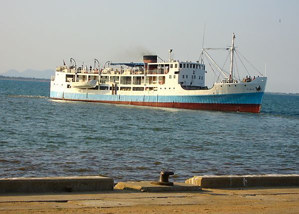
Nkhata Bay lies about 50km east of Mzuzu and is the most popular northern lakeshore resort, and is one of the lakeshores most scenic villages consisting of two bays separated by a long narrow peninsula. One of the bays is mainly a port where the Lake Malawi steamer docks, the other, Chikale Beach is a backpackers heaven. The sunrise and sunsets are quite picturesque and the atmosphere very laid back.
Facilities in the village include a bank, a post office, numerous small grocery stores and many establishments offering western food. There is also a lively market extensively selling curios and clothing.
Scuba diving courses are available. Nkhata Bay it is reputed as being one of the cheapest places in the world to qualify, needless to say they are very popular and you may have to book in advance.
In recent years the whole area has become especially popular with backpackers. There are numerous places to stay strung out along the main road, through the town and on Chikale Beach. The most popular spot on Chikale beach is Njaya lodge run by an English couple. The accommodation consists of bamboo style huts, that blend in with the scenery, situated on the hillside overlooking the bay. This is definitely a place where you can totally unwind, the food on offer is good. At the other end of the beach is the Chikale Beach Resort.


Chintheche
This village lies about 40km south of Nkhata Bay, and has a few small shops, a market, mosque and bank that is only open twice a week. The lakeshore north and south of the village has long, white stretches of fine sandy beaches. All along the main road from Nkhata Bay to Nkhotakota, small dirt tracks lead to a variety of camping sites, lodges and hotels suitable for all types of traveller.
Dwangwa
A village lying 14kms further south, dominated by the Kasasa Sugar Estate. Visitors to this area can stay at the Kasasa Club which offers a golf course, swimming pool, attractive club house with a bar and restaurant, and self contained chalets. Drinks are subsidised for the estate workers so are cheaper than anywhere else.
Nkhotakota
Between Nkhotakota and Dwanga there are not many places to stay. Nkhotakota, for much of the 19th century, was the centre of slave trading, with as many as 20,000 slaves being transported across the lake into Tanzania every year. This was finally stopped in the 1890's when Dr. Livingstone met with Jumbe, the local chief and persuaded him to sign a treaty abondoning the slave trade.
There are several resthouses to stay at within the town. There is little to see in this region but venturing inland takes you through Nkhotakota Wildlife Reserve
Salima - Senga Bay
Salima is located inland approx 20kms from the lake, it is the closest town to Senga Bay where you can stock up on provisions. There is also a few fairly good markets, banks, a post office and bus station. Asides from that there is not much to attract tourists to spend a night unless they are catching an early morning bus. Most people head off to Senga Bay where there are several beach lodges along the lakeshore.
Most of the lakeshore establishments in Senga Bay are able to arrange water sports, such as wind surfing, water- skiing, snorkelling and boat rides to nearby islands. This is an excellent area for bird watching and hiking, although it is advisable to go with a guide. Along the main road you will find many curio sellers, where good bargains can be had.


Cape McClear
The southern Lakeshore extends from Chipoka through Cape Maclear, Monkey Bay to the Southern tip of the lake at Mangochi. This is also the source of the Shire river, the only outlet from Lake Malawi.
The Cape Maclear area is one of the most lively areas and very popular with budget travellers. It is surrounded by beautiful scenery and bordered by a range of mountains, plus it forms a large part of the Lake Malawi National Park.


Mzuzu is the gateway to the Northern Region of Malawi and as such is considered the best base from which to explore the spectacular scenery of the Viphya and Nyika Plateau, Vwaza Marsh as well as the Khondowe Plateau overlooking the Lake.
Mzuzu has a climate ideal for agriculture and the two most important crops produced on the slopes of surrounding mountains are coffee and rubber. With its high rainfall and many pine plantations Mzuzu is noted for its greenness throughout the year.
The city is served by daily buses from most other major centres. a regular Air Malawi service and fine tarred roads which link Mzuzu with Lilongwe and Karonga in the north.
The road heading north, is one of Malawi's most spectacular. Rising from the rich Henga Valley, which divides the Viphya Mountains from the Nyika Plateau and reaches a height of 1100m before winding down to the Lakeshore.
Whilst in the Northern Region it is worth visiting the Nyika National Park and the Vwaza Marsh Game Reserve
Lilongwe, referred to as the city with a split personality, was named after the river which runs through it and which joins the nearby Linthipe River on its lakeward journey. Today this young City is known both as the Capital City and the Garden City, add to those the Old and the New Town and you'll know exactly where the nickname originates. It is serviced by road and rail networks as well as international flights.
Lilongwe nestles in the central African plateau, mountains and hills dot the landscape around the City and many of these are well worth visiting if only for the breathtaking panoramic views they afford. The City itself has been carefully designed with modern architecture complimented by carefully tended public gardens. These boast a wide array of brilliantly coloured tropical blooms and plants. During March and April rows of dazzling yellow acacia trees line the city streets and in winter bright red poinsettia add splashes of colour to the landscape, soon followed by the lilac of jacarandas in bloom.
In the centre of Lilongwe, between the Old and New towns, the Lilongwe Nature Reserve, an area of 120ha, was established to give visitors an idea of what the area looked like before construction of the city began. The sanctuary is not a city zoo and when walking along the footpaths visitors should be as alert as in the bush, especially as leopard and hyena have settled here.
Many small animals can be spotted here, including porcupine, civet, serval, vervet monkeys, bushbabies and squirrels as well as larger game such as bushbuck, duiker and bushpig who now inhabit this pocket of green surrounded by a growing city.
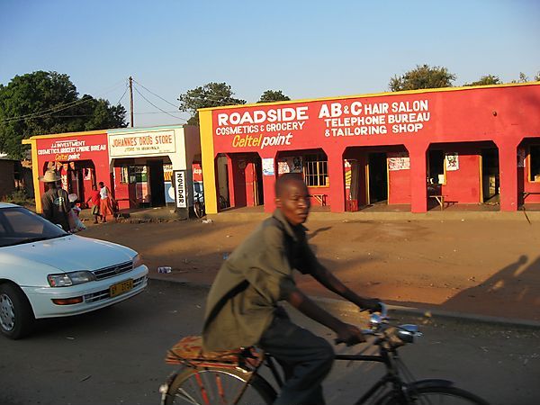
From the imposing administrative centre of Capital Hill to the lively bustling atmosphere of the Asian quarter, Lilongwe is a city of contrasts. Tailors decorate pavements with colourful garments while at sunset the air is filled with the sounds of the muezzin calling the faithful to prayer in the mosque.
No visit to Lilongwe is complete without a visit to the old market in Malangalanga Road. The air here is rich with the smell of dried fish mingled with fresh vegetables. Here visitors can purchase anything from live chickens to dustbins artfully crafted by tinkers on the spot.
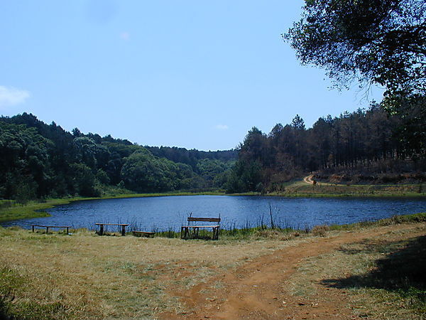
Approximately 165km north of Lilongwe lies the Kasungu National Park, which is definitely worth the visit at the right time of the year and 115km north east of Lilongwe is the Nkhotokota Game Reserve
Zomba
Zomba is 290km south of Lilongwe and 72 km north of Blantyre. Up until the mid 1970's Zomba was the capital city of Malawi. It lies at the foot of Zomba plateau, amongst blue gum trees. Many of the buildings are of colonial style architecture, the most prominent being the Gymkhana Club (Zomba's Golf Club House). Most supplies are available in the town and outside the main shops you can spend hours haggling for the best bargain with several of the many craft sellers. Zomba also houses one of the largest, most colourful and liveliest markets in Malawi.
The main attraction in the area is the Zomba Plateau , which offers a pleasant variety of walks/hikes through forest, beside streams and across open grassland. If you venture just 60km north you can visit the Liwonde National Park


Blantyre
Blantyre is Malawi's largest city situated in the Southern Region and includes the two communities of Blantyre and Limbe which are joined by an eight kilometre stretch of highway. Blantyre, Malawi's oldest municipality is the country's main commercial, industrial and communications hub and is set in the Shire Highlands.
The city is surrounded by some of the most beautiful hills and mountains in Malawi. A typical view from a city street could include Michiru, the rain mountain, a glimpse of Mount Soche or a passing glance of Ndirande, sleeping man mountain, looming behind a suburb.
The hills which surround the City are in fact the first layer of an echo of hills which stretch to the Kirk Range, the Zomba Plateau and Mount Mulanje. Blantyre's hills all have something special to offer. Most have patches of evergreen forest, wild orchids, aloes and numerous birds and always incredible views. Perhaps the most interesting is Michiru with its Mountain Conservation Area.
The Michiru Mountain is in fact an ongoing experiment in conservation where emphasis is placed on demonstrating wise land use. The Conservation Area has been divided into three sections, a forestry reserve, farming area and nature reserve for the improvement of natural resources. Visitors to the area can drive to the summit to enjoy spectacular views of Blantyre itself, Zomba, Mulanje and the Shire Valley.
The City of Blantyre has much to offer visitors in the form of historical sights. These include the Blantyre Mission, the place where the City came into being, and the beautiful church of St Michaels and All Angels. Then there is the Mandala House, erected in 1882, the oldest building in Malawi and March 3 House used by Dr Banda as a base from which to lead Malawian's to independence.
The Museum of Malawi, also known as the Chichiri Museum, is located beside the civic centre of Blantyre at Chichiri, and is the major exhibition centre for both the natural and cultural heritage of the country.
Blantyre's position offers easy motoring to a number of Malawi's most interesting places. These include Zomba, renowned for its curio and produce markets and only 59km away, and Thyolo's lush tea-growing estate 39km from the city. Other places of interest which can be reached from Blantyre within an hour's drive is Mfunda Falls at Matope and Lengwe National Park.
With its more temperate climate, Limbe was favoured as a residential site for early settlers. The streets of Limbe are a continuous bustle of people and traffic and there can be no doubt that commerce is the lifeblood of the town. An abundance of Asian shops in close proximity, most selling either clothing or hardware items, lead to much good natured haggling.
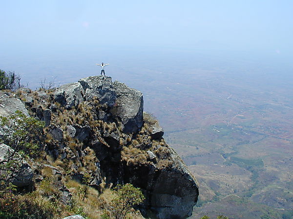
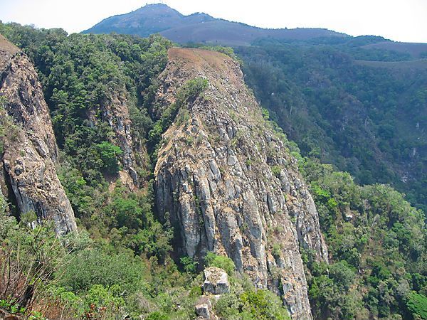
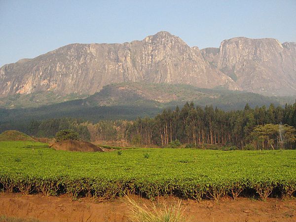
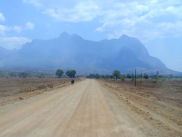
Mulanje Mountain is Malawi's premier hiking and rock climbing destination offering some of the most spectacular scenery in the country. The Massif rises up to 3,000 metres, with the highest peak being Sapitwa at 3,002 mtrs and covers an area of more than 1,000 sq km. On its slopes grow the Mulanje cedars, some of them over 200 years old. Deep gorges, impressive waterfall and trout streams cut their paths from its heights, while in the lush foothills are tea plantations. The Chambe, west face direct, is claimed to be one of the longest rock climbs in Africa, offering 1675mtrs of roped climbing. There are a couple of regular routes climbed, starting at Likhubula Forestry Station these are the Skyline Path to Chambe Basis and the Lichenya Path to Lichenya Plateau.It is worth spending a couple of days at the forestry station, which is surperbly located close to rock pools and waterfalls. A Guide to the Mulanje Massif is widely available in Blantyre and the Map Sales office sells an excellent map of the Massif. Rock climbers and hikers planning to use unusual routes are advised to contact the Mountain Club of Malawi in Blantyre.

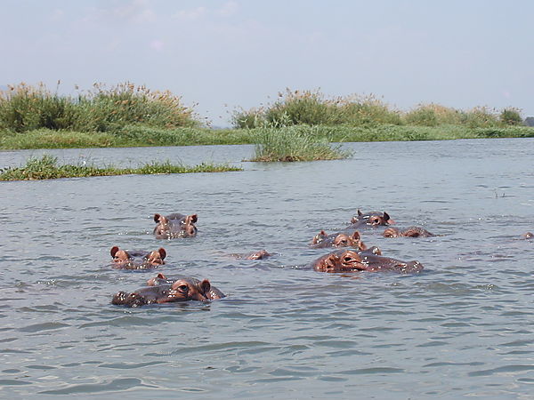
The M1 southwest of Blantyre, takes you down the escarpment, to the Shire Valley, giving breathtaking views over the Rift Valley lowlands towards Mozambique. This area of Malawi is little visited by tourists and can proof quite difficult for visitors without their own transport, but it has some worthwhile attractions including two game reserves; the Majete Wildlife Reserve and Mwabvi Wildlife Reserve as well as the Sucoma Sugar Estate and the fascinating Elephant Marsh. Boat trips to explore the Marsh can be organised in Mchacha James a small village approx 15kms from Bangula. This area is home to the largest population of crocodile in the country and many hippo. It is also bird watchers paradise with large numbers and many varieties to be found.
